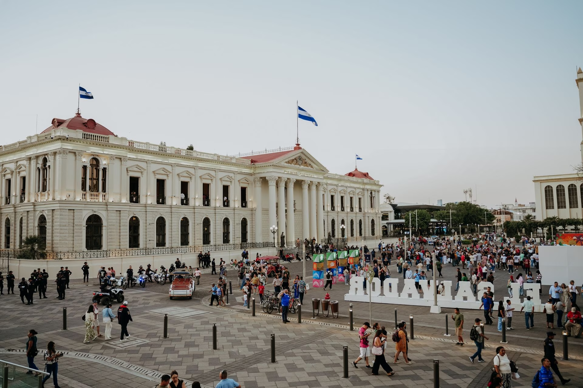
San Salvador → Ruta de las Flores → Santa Ana & Lake Coatepeque → Surf Coast
El Salvador Itinerary: 8 Days in San Salvador, Ruta de las Flores & the Surf Coast
A few years ago, El Salvador barely appeared on a Central American itinerary at all. That's changed fast: a dramatic security crackdown has transformed the country's reputation, and travel content genuinely hasn't caught up yet. This route runs from a regenerated capital through the flower-painted hill towns of the Ruta de las Flores, past volcanoes and a crater lake, and down to the Pacific surf coast, where the international airport sits close enough to make the whole loop feel almost linear.
Why El Salvador
El Salvador spent decades as the destination Central America travellers routed around. That's changed with genuine speed: a sweeping security crackdown beginning in 2022 has driven homicide rates down dramatically, and the country now markets itself, credibly, as one of the region's safer destinations. What that means for a traveller right now is a rare window, a small, geographically compact country with volcanoes, crater lakes, colourful colonial-era hill towns and a genuinely excellent Pacific surf coast, still years away from the crowds and saturated content of Costa Rica or even neighbouring Guatemala.
This route is a loop that reads almost like a straight line: two days in San Salvador, a regenerating capital worth more time than its reputation suggests, two days on the Ruta de las Flores, a string of hill towns painted in murals and famous for weekend food fairs, a day around Santa Ana's volcano and the near-perfect crater of Lake Coatepeque, and three days closing out on the surf coast at El Tunco and El Zonte, the beach that put itself on the map as "Bitcoin Beach." The international airport sits close to this last stretch, so the trip finishes right where it needs to.
The honest caveat, and it matters here more than in most guides in this series: read the current safety situation for yourself before you go, not from this paragraph. Sources genuinely disagree, some report a US Level 1 advisory ("exercise normal precautions," the same rating as Switzerland), others report Level 2 ("exercise increased caution," the same as France or Germany). Both can be true at different points in the same year as ratings get updated. Carry ID at all times, military checkpoints on highways are routine under the country's ongoing "state of exception," and stick to the well-established tourist corridor between the capital, the flower route and the coast, which is consistently reported as the calmest part of the country.
Planning
November to April is the dry season and the best window for this whole route: clear skies for volcano views around Santa Ana and Cerro Verde, dry roads through the highlands, and consistent surf on the Pacific coast. December through February brings the most reliably comfortable temperatures across the whole country.
May to October is the wet season, rain tends to fall in strong afternoon bursts rather than all day, and the highlands turn a vivid green that suits the Ruta de las Flores' name. It's cheaper and quieter, but expect some road delays in the hills and less consistent surf conditions.
Whichever season, weekends bring the Ruta de las Flores to life properly, several towns run weekend food fairs (Juayúa's is the best known), so if your dates allow it, try to have a Saturday there.
Map
San Salvador, Days 1–2
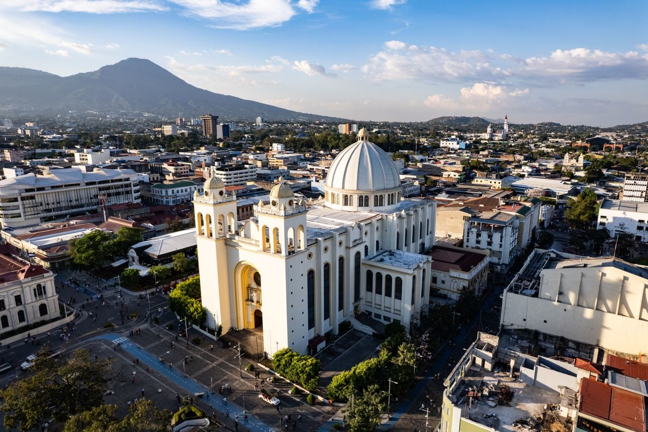
San Salvador isn't a conventional tourist capital, and two days is the right amount of time to see why it's worth more attention than it gets: a historic centre undergoing genuine regeneration, a striking modern-meets-colonial skyline against a ring of volcanoes, and a city that, by most current accounts, feels calmer and more walkable than its reputation from a decade ago suggests.
Start in the Centro Histórico, the historic centre, recently revitalised with a new public library, restored plazas and improved lighting and police presence. See the Metropolitan Cathedral, the crypt of Archbishop Óscar Romero, a defining figure in the country's civil war history, and the Palacio Nacional, an elegant early-20th-century government palace now open as a museum. The Plaza Barrios and surrounding streets are best visited during the day.
Visit the MUNA (Museo Nacional de Antropología) for context on El Salvador's pre-Columbian and colonial history, well curated and a useful primer before heading to the Ruta de las Flores, which shares much of this cultural thread. In the evening, head to Zona Rosa or Colonia Escalón, the modern, upscale districts where most of the city's restaurants and bars operate, and where the transformation in atmosphere from the historic centre is most obvious.
Take a short drive up to El Boquerón National Park, the crater of the San Salvador Volcano looming over the city, for a walk around the rim and, on a clear day, views stretching to the coast. It's an easy half-day and a good way to understand the volcanic geography that shapes the whole country.
Spend the afternoon in La Gran Vía, a modern open-air shopping and dining complex that's become a symbol of the city's recent confidence, or walk through Parque Cuscatlán and the nearby Museum of the Word and Image (MUPI), which covers the civil war period with unflinching honesty. This is also a good day to simply talk to people, San Salvador's transformation is a genuinely live topic locals have strong, often complicated feelings about.
Where to eat in San Salvador
Ruta de las Flores, Days 3–4
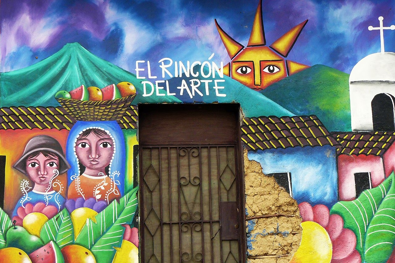
The drive west from San Salvador climbs into coffee country, and the "Route of Flowers" strings together a handful of small highland towns known for colourful murals, weekend food fairs and some of the best coffee in Central America. It's a slow, scenic couple of days, best done with a rental car so you can stop wherever the road demands it.
Drive to Juayúa, the best-known stop on the route, famous for its weekend food fair (feria gastronómica) filling the central plaza with stalls selling grilled meats, seafood and local specialities, best experienced on a Saturday or Sunday. Visit the town's church, home to a striking black Christ statue, and, if you're up for a short hike, the Los Chorros de la Calera waterfalls just outside town.
Coffee is serious business here; a short tour of a local finca (farm) explains the process from bean to cup, and the region's altitude produces genuinely excellent, distinctive coffee. Overnight in Juayúa or push on to Ataco for the night.
Spend the morning in Concepción de Ataco, the most photogenic town on the route, its streets covered in colourful, detailed murals depicting local history and culture. Wander without much of a plan, this is a town built for slow walking and coffee stops, and the murals alone justify a couple of unhurried hours.
Continue to Apaneca, the highest town on the route and a good base for zip-lining, mountain biking or a visit to the nearby Laguna Verde crater lake. If your route allows, this is also a good place to try Salvadoran ziplines through the coffee-farm canopy, a fun, low-key adventure activity that's easy to arrange locally.
Where to eat on the Ruta de las Flores
Santa Ana & Lake Coatepeque, Day 5
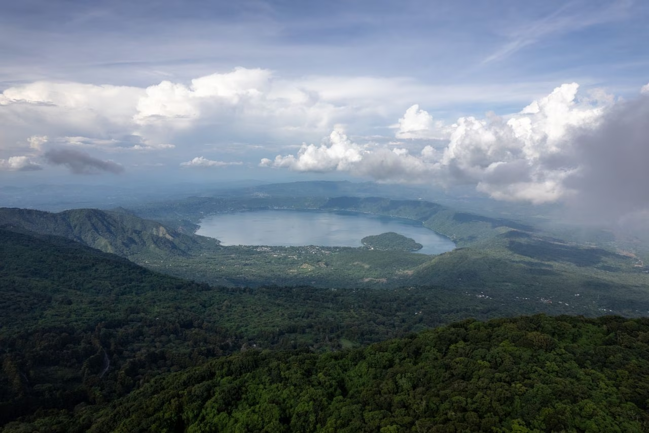
A short drive from the Ruta de las Flores, El Salvador's second city and its most striking crater lake pack a lot into a single day: a handsome colonial centre, one of the country's most climbable volcanoes, and water so improbably turquoise it looks digitally enhanced in photos.
Start in Santa Ana, whose handsome central square is anchored by a striking neo-Gothic cathedral and the ornate Teatro de Santa Ana, one of the finest theatres in Central America. If you're up for a proper hike, the Santa Ana Volcano (Ilamatepec), the country's tallest, has a guided trail (guides are required and easily arranged) to a crater lake at the summit, a half-day round trip.
For an easier, equally rewarding option, head to Cerro Verde National Park for a gentle loop trail with views across to both the Santa Ana and Izalco volcanoes. Finish the day at Lake Coatepeque, a volcanic crater lake with strikingly turquoise water, ringed by lakeside restaurants and a handful of small hotels, a genuinely beautiful and relatively undervisited spot to swim or simply sit with the view.
Where to eat near Santa Ana & Coatepeque
Surf Coast: El Tunco & El Zonte, Days 6–8
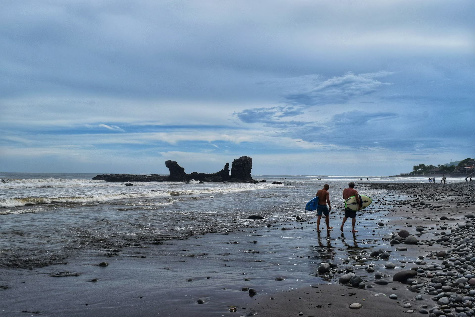
The Pacific coast around La Libertad is where El Salvador's surf reputation was built, consistent, powerful point breaks that have drawn a small but dedicated international surf crowd for years, well before the rest of the country reopened to tourism. El Tunco and El Zonte, a short drive apart, anchor this stretch, and the international airport sits close enough that this makes a natural final leg.
Drive down to the coast, roughly two to three hours from Lake Coatepeque. El Tunco is the liveliest beach town on this stretch, named for a rock formation just offshore, with a compact strip of surf shops, hostels and beach bars. Take a beginner surf lesson if you haven't before, the beach breaks here are genuinely good for learning, or simply settle into beach time if you're not surfing.
Watch the sunset from the beach or one of the bars right on the sand, El Tunco's evenings have a laid-back, international backpacker energy that's become one of the coast's defining features.
Take the short drive to El Zonte, a quieter fishing-village-turned-surf-town that became globally known as "Bitcoin Beach" after a grassroots project began using cryptocurrency for everyday local transactions years before El Salvador made Bitcoin legal tender nationally in 2021. The novelty has faded somewhat as a talking point, but the beach itself, a right-hand point break with fewer crowds than El Tunco, is arguably the better surf spot.
Spend the day surfing, swimming or simply comparing the more laid-back, less touristy pace here with El Tunco the day before. A handful of good small restaurants and boutique guesthouses have opened here in recent years without the town losing its essentially quiet character.
Use the final morning for one more surf session, a walk along the point at El Zonte, or a relaxed breakfast back in El Tunco if you're staying there. If you have a little extra time, Los Cobanos, further down the coast, has El Salvador's best snorkelling and a small stretch of coral reef, worth considering as an alternative final stop.
Allow around 45 minutes to an hour to San Óscar Arnulfo Romero International Airport (SAL), which sits close to this stretch of coast, closing the loop without a long final transfer. From here you fly home, having crossed a genuinely fast-changing country from a regenerating capital to some of Central America's best surf.
Where to eat on the Surf Coast
Getting around
A rental car gives you the most freedom on this route, especially for the Ruta de las Flores, where stopping wherever the road demands it is half the appeal. Shuttle services also run the main tourist corridor if you'd rather not drive; roads on this route are generally in good condition, though mountain roads in the flower route are winding.
| San Salvador → Ruta de las Flores | Rental car · around 1.5–2 hours to Juayúa · shared shuttles also run from San Salvador on a fixed schedule, a good option if you'd rather not drive the mountain roads. |
| Ruta de las Flores → Santa Ana / Coatepeque | Rental car · around 30–45 minutes, a short and easy hop between the flower route and Santa Ana. |
| Santa Ana / Coatepeque → Surf Coast | Rental car · around 2–2.5 hours down to La Libertad, El Tunco or El Zonte. |
| Surf Coast → SAL Airport | Rental car or pre-arranged transfer · around 45 minutes to an hour, one of the shorter airport transfers of any route in this guide series. |
| Within towns | On foot. San Salvador's tourist districts, the Ruta de las Flores towns, Santa Ana's centre and the surf towns are all compact and walkable. Use registered taxis or ride-hailing apps for longer city hops. |
What's worth booking
Most of this trip runs on a rental car and showing up, but a few things are worth reserving ahead, either for safety reasons or because the better options fill up in peak season.
Where to stay
Accommodation ranges from modern international hotels in San Salvador's Zona Rosa to boutique guesthouses in the Ruta de las Flores towns and a full spectrum of surf hostels to boutique beachfront hotels on the coast. Stick to well-reviewed, established places across the board, this is still a maturing tourism market.
How to eat well
Salvadoran food is simple, corn-based and deeply comforting, built around the pupusa, but there's real range once you look past it: fresh Pacific seafood on the coast, excellent highland coffee, and a street-food culture that rewards eating where the queue is longest. Prices are generally low, and the country's dollarized economy means no currency conversion headaches for anyone already used to thinking in dollars.
Tipping isn't traditionally expected but is increasingly appreciated in tourist-facing restaurants, particularly on the coast and in San Salvador's upscale districts, 10% is a reasonable, generous gesture.
Dishes worth knowing
| Pupusas | Thick, hand-patted corn tortillas stuffed with cheese, refried beans, pork (chicharrón) or a mix, griddled and served with curtido (pickled cabbage slaw) and tomato salsa. The national dish, eaten constantly, and the single most important thing to try in the country. |
| Yuca frita | Fried cassava, often served with curtido and a vinegary pork or chicharrón topping, a popular street-food snack alongside pupusas at markets and food stalls. |
| Sopa de pata | A hearty, slow-cooked soup made with cow's foot, vegetables and plantain, a traditional weekend dish. An acquired taste for some visitors, but a genuine window into home cooking. |
| Salvadoran coffee | Grown at altitude in volcanic soil around the Ruta de las Flores and Santa Ana, among the best and most underrated coffee in Central America. Worth seeking out a proper cup at a farm rather than only the instant version served in some casual eateries. |
| Fresh Pacific seafood | Grilled fish, ceviche and garlic shrimp on the surf coast, simply prepared and consistently good. El Tunco and El Zonte's beachfront restaurants are the best place to try it. |
Travel essentials
What to pack
El Salvador's climate is tropical, and this route spans a genuine range: warm lowland heat in San Salvador and the coast, noticeably cooler evenings in the Ruta de las Flores highlands, and proper sun exposure on the volcano hikes and beach days. Pack for both heat and altitude, and don't forget your passport for those highway checkpoints.
- Lightweight, breathable clothing for the coast and lowlands
- A light layer or jacket for cool evenings in the Ruta de las Flores highlands, genuinely chilly after dark at altitude
- Sturdy shoes for the Santa Ana Volcano and Cerro Verde hikes
- Swimwear and quick-dry clothing for Lake Coatepeque and the surf coast
- A rash guard or wetsuit top for surf lessons if you burn easily
- Passport valid 6+ months, carried or photocopied at all times for highway checkpoints
- Travel insurance covering private hospital treatment
- US Dollars in cash for small vendors, tips and markets; cards work in cities and tourist areas
- International driving permit if renting a car
- eSIM, activated before landing
- Universal adapter, El Salvador uses 115V Type A/B plugs (same as the US)
- Power bank for driving days between stops
- High-SPF sunscreen and a hat for volcano hikes and beach days
- A reusable water bottle; bring more water than feels necessary on the Santa Ana hike
- A dry bag for phones and valuables on the coast
Before you go
| Visa | US citizens need no visa. Many other nationalities, including EU, UK, Canada and Australia, can enter visa-free or purchase a low-cost Tourist Card on arrival for some nationalities. Check the current requirement and fee for your passport before you fly, El Salvador is also part of the CA-4 regional agreement with Guatemala, Honduras and Nicaragua. |
| Currency | US Dollar, the official currency since 2001. No exchange needed for US travellers; everyone else can withdraw dollars directly from ATMs. Cards are widely accepted in cities and tourist areas; carry cash for smaller towns and markets. |
| Language | Spanish. English is spoken in hotels, tour operators and tourist-facing restaurants but limited elsewhere; basic Spanish phrases go a long way, especially in the Ruta de las Flores towns. |
| Connectivity | Good 4G along the main tourist corridor (San Salvador, Ruta de las Flores, Santa Ana, the coast); patchier in remote rural areas. A local SIM or eSIM is cheap and worth activating on arrival. |
| Health | No mandatory vaccinations for most visitors, though check current recommendations. Use private healthcare facilities, well-equipped and used to treating foreign visitors, rather than the public system. Tap water isn't recommended for drinking, stick to bottled or filtered. Emergency number: 911. |
| Electricity | 115V, Type A/B plugs, the same as the United States and Canada. Travellers from the UK, EU and most other regions need an adapter. |
What it costs
El Salvador is one of the more affordable Central American destinations, comparable to or slightly cheaper than Guatemala, and noticeably less expensive than Costa Rica. The rental car and any guided activities (volcano guide, surf lessons) are the main variable costs.
What pushes costs up: a rental car in peak season, dining exclusively in San Salvador's upscale districts, and private guided tours for every activity. What keeps costs down: eating pupusas and street food, travelling in the shoulder months, using shared shuttles instead of a private car, and self-driving the Ruta de las Flores rather than booking a guided tour.